|
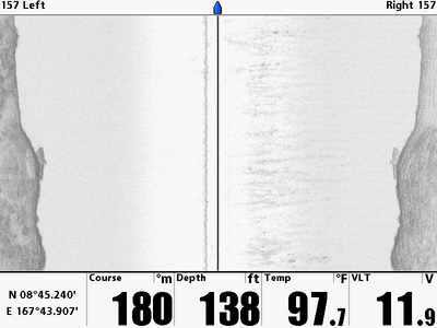
Here's a side scan sonar image if the wreck. |
| Latitude | Longitude | ||||
| Degrees | Minutes | Seconds | Degrees | Minutes | Seconds |
| 8 | 45 | 17.940 | 167 | 43 | 55.320 |
| 8 | 45.29900 | --------- | 167 | 43.92200 | --------- |
| 8.75498 | --------- | --------- | 167.73203 | --------- | --------- |
This was also early in my photography career. I have a couple shots, but none are too great. Perhaps I'll post them until I have something better.
I suspect this might be an LCC, but I could certainly be wrong, so if I get more information the name of this wreck could change.
I do remember a hatch in the rear and looking in at two large deisel engines which seem to match the LCC data. It is a steel hulled ship and it is sitting upright on the bottom.

|
Here's a side scan sonar image if the wreck. |
| From: Little Bustard LCC | ||
|---|---|---|
| Attraction | Distance (feet) | Bearing (deg mag) |
| ER-2 Coral Head | 739 | 356 |
| Little Bustard Duo | 437 | 107 |
| Little Bustard LCM | 657 | 94 |