Choko/Tyoko Maru


Local Name:

Barracuda Junction

Depth:

While the hull is maybe around 80 feet, the bottom is a little better than 130 feet.

Anchoring:

This is another wreck that is generally buoyed by the scuba club. There is generally a sub-surface and a surface buoy here. The surface buoy SHOULD have a tag line that you can tie off to. As always, bring a second anchor down as a safety.

Location:

Latitude Longitude
Degrees Minutes Seconds Degrees Minutes Seconds
8 44 25.800 167 42 39.360
8 44.43000 --------- 167 42.65600 ---------
8.74050 --------- --------- 167.71093 --------- ---------

Notes:

This wreck lies facing roughly northeast on its' port side. There is a bow gun that is pointing up towards the surfce. A load of pipe is spilling out of the holds.

Photos:

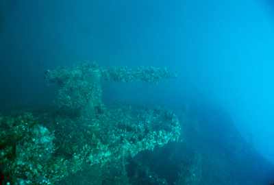
Here's a shot of the bow gun taken from above and slightly behind the gun.
Here's a view of the gun from what would be immediately above it if the ship were upright. Since the ship rests on its' port side the shot is taken from the side. The ammo boxes can be see on the right of the gun platform.
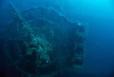
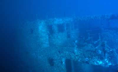
This is a shot of the backside of the bridge area.
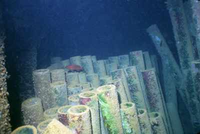
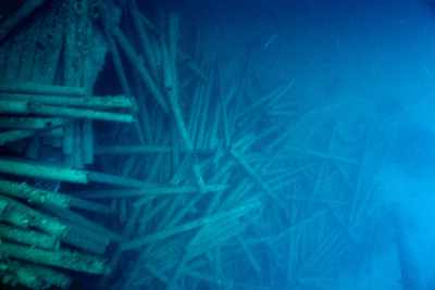
This ship was carrying a cargo of pipes when it was sunk.
There must have been a great demand for pipes!
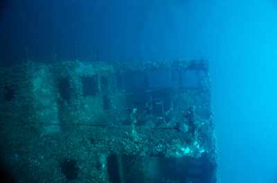
And a slighly different view of the back side of the bridge area.


Go to Map Based Wreck Directory

Go to List Based Wreck Directory

Go to Wreck Page

Go to Scuba Diving Page

Go to Dave Fortin's Homepage

Send e-mail to Dave Fortin


This page has been accessed 14 times.

Created by Dave Fortin

Fri Apr 19 08:32:32 UTC 2024