Tateyama Maru


Local Name:

K-5 Side

Depth:

While approximately 80 feet to reach the hull, the bottom is a little over 130 feet.

Length and Orientation info:


The approximate length and approximate orientation of the ship are deteremined based on the lat and lon of the bow and stern. Typically, the lat/lon information was obtained by attaching a line with a float to the wreck and marking the position of the float with a handheld GPS receiver. We try to get the line as near vertical as possible, but there is bound to be some error. Also, the GPS position will have a certain error in it as well. So, this information will be reasonable, but not 100 percent accurate.

Stern Position:
Latitude : 8 deg 44.443 min 0 sec
Longitude: 167 deg 42.993 min 0 sec

Bow Position:
Latitude : 8 deg 44.472 min 0 sec
Longitude: 167 deg 43.043 min 0 sec

Approximate length: 349 feet

Approximate orientation: 51 deg mag

Anchoring:

The scuba club generally maintains a sub-surface and surface buoy on this wreck. If intact, there should be tag line attached to the surface buoy to tie off on. As always, I'd bring a second anchor down and tie into the wreck just in case!

Location:

Latitude Longitude
Degrees Minutes Seconds Degrees Minutes Seconds
8 44 27.180 167 43 .900
8 44.45300 --------- 167 43.01500 ---------
8.74088 --------- --------- 167.71691 --------- ---------

Notes:

This ships is facing roughly northeast and lies on its' starboard side. Just behind the main cabin area there is a hold loaded with large shells. They appear to have been in crates of 4. Each shell is maybe on the order of 4 or 5 inches in diameter. Hundreds of these shells are spilling out of the hold!

There are gun mounts toward the bow and stern, but no guns are present.

Several anemones can be found along the ship if you look closely.

Photos:

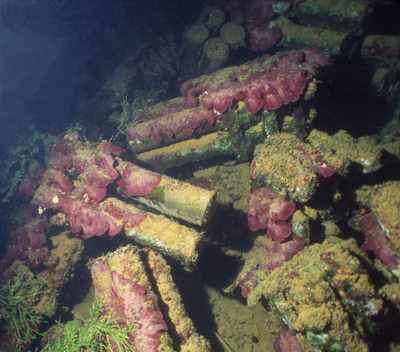
One of the more popular sights to see on this wreck is the ammo filled hold! It is just behind the main cabin area and in front of the stern gun. Since the ship is laying on its' starboard side, the cargo of ammo crates is now spilling out of the hold. It should go without saying, but this is a place to look and not touch!
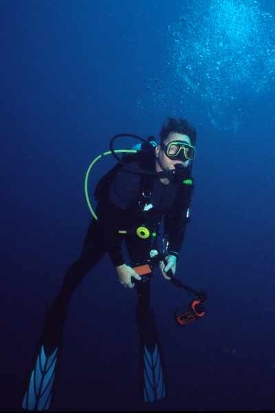
Here's Doug Curry during our safety stop.
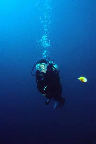
Karen DeGroff taking a few minutes for a safety stop.
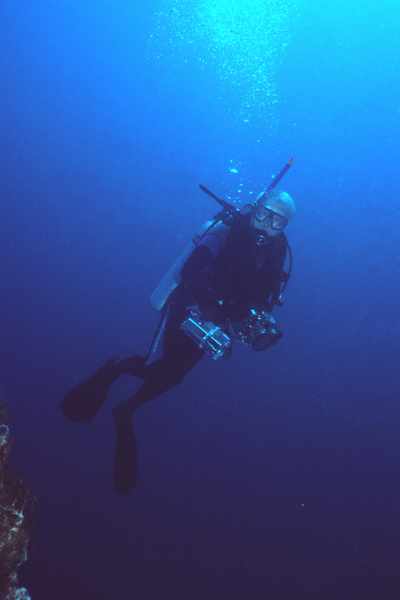
And finally, Kent DeGroff at the safety stop!
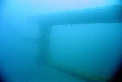
The kingposts are seen here now resting almost horizontal.
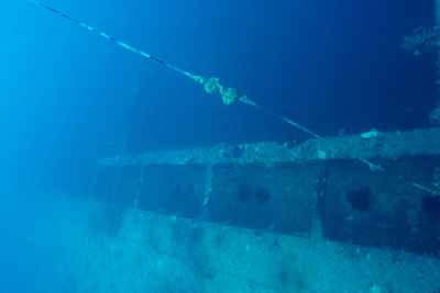
This must have been paradise for porthole hunters when wreck diving started cathing on at Kwajalein!
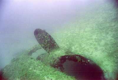
The huge prop and rudder.

Nearby Attractions:


A few words of caution are due here!

While I believe that this data is fairly accurate, one must apply some common sense when using this data. If the point of origin is a coral head, you may have anchored at a slightly different spot than I did and your bearing to the next attraction could be slightly different than mine. I suggest checking with your own GPS before rolling in!

Also, know roughly how fast you swim so that you know approximately how long it should take to reach the next attraction. You can (and likely will) miss things from time-to-time and you should know when to abort and turn around before you are too far from your boat.

I strongly urge you to try the shorter swims first and build your navigation skills. I have set the cutoff distance for this table to 750 feet, but that is a considerable challenge even for the best navigators. An error of more than a few degrees in poor visibility and you can easily miss your destination at the extreme ranges!

From: Tateyama Maru
AttractionDistance (feet)Bearing (deg mag)
Type-X Barge 592 350
Asakaze Maru 389 118


Go to Map Page for This General Area

Go to Map Based Wreck Directory

Go to List Based Wreck Directory

Go to Wreck Page

Go to Scuba Diving Page

Go to Dave Fortin's Homepage

Send e-mail to Dave Fortin


This page has been accessed 2106 times.

Created by Dave Fortin

Thu May 23 08:13:28 UTC 2013