Taiyo Maru No. 2


Local Name:

Gugeegue Rubble #2

Depth:

This wreck is at approximately 100 feet.

Anchoring:

There is a small coral head immediately north of this wreck that makes for a handy anchoring point. However, I have found that after exhausting my bottom time on the wreck, you can get a little bored circling this coral head for the rest of the dive. The wreck is close enough to shore that you can really anchor in the shallows directly in from the wreck and swim out to the wreck without any problem.

Location:

Latitude Longitude
Degrees Minutes Seconds Degrees Minutes Seconds
8 50 49.380 167 44 21.240
8 50.82300 --------- 167 44.35400 ---------
8.84705 --------- --------- 167.73923 --------- ---------

Notes:

This is a true rubble wreck. Being of wooden construction, there isn't much left except a few metal components.

Photos:

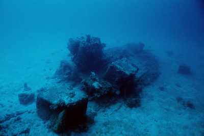
Here we see an overview of the ship. The engine and and what appear to be fuel tanks are the most obvious features.
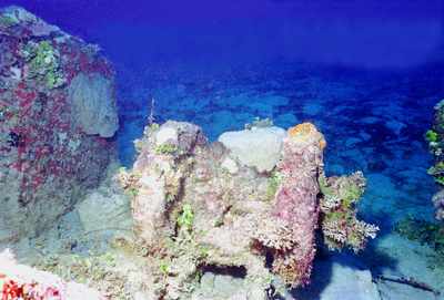
Close-up of the cylinder heads on the engine. It appears to be very similar to the Concrete Wreck off of Emon beach and the South Loi Wreck.
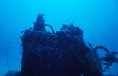
I'm told that this is a little single cyclinder engine.
Another shot of the single cylinder engine. This time we see an octopus peeking out through a hole in the water jacket.
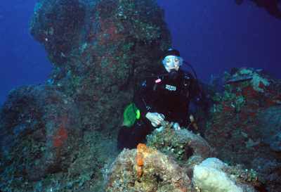
Linda Fluke poses with the little single cylinder engine with beer in hand! Could she have a drinking problem? Apparently her dad rebuilds engines like this for a hobby.
Just another overview shot of the ship. From this distance the outline of the ship is rather obvious. It seems to me that as you get closer it becomes less distinct.

Nearby Attractions:


A few words of caution are due here!

While I believe that this data is fairly accurate, one must apply some common sense when using this data. If the point of origin is a coral head, you may have anchored at a slightly different spot than I did and your bearing to the next attraction could be slightly different than mine. I suggest checking with your own GPS before rolling in!

Also, know roughly how fast you swim so that you know approximately how long it should take to reach the next attraction. You can (and likely will) miss things from time-to-time and you should know when to abort and turn around before you are too far from your boat.

I strongly urge you to try the shorter swims first and build your navigation skills. I have set the cutoff distance for this table to 750 feet, but that is a considerable challenge even for the best navigators. An error of more than a few degrees in poor visibility and you can easily miss your destination at the extreme ranges!

From: Taiyo Maru No. 2
AttractionDistance (feet)Bearing (deg mag)
Gugeegue Coral Head 295 14
Gugeegue LCM 625 159


Go to Map Page for This General Area

Go to Map Based Wreck Directory

Go to List Based Wreck Directory

Go to Wreck Page

Go to Scuba Diving Page

Go to Dave Fortin's Homepage

Send e-mail to Dave Fortin


This page has been accessed 927 times.

Created by Dave Fortin

Fri Sep 3 01:50:57 UTC 2010