LCU-22


Depth:

This wreck is about 120' to the main deck.

Anchoring:

There's nothing terribly special about anchoring on this wreck. The bottom is deep and generally sandy. I generally head about 100' past the wreck into the wind and drop the anchor. My preference is to anchor with one anchor and then once we come to a stop I drop the second anchor straight down with enough extra rope for scope to serve as a backup should the primary fail. I like this approach since I generally can pull my backup anchor up w/o a problem and then I only need to be concerned with getting the primary free. Use your best judgment and do what you are most comfortable with. Since it is a sandy bottom I wouldn't really recommend this for a terribly windy day.

Location:

Latitude Longitude
Degrees Minutes Seconds Degrees Minutes Seconds
8 48 28.140 167 43 44.820
8 48.46900 --------- 167 43.74700 ---------
8.80781 --------- --------- 167.72911 --------- ---------

Notes:

I attached a temporary sub-surface marker a few months ago. As of 12/19/2004 it was still in place. It is a fishing float down at 15' or so. It is attached to the wreck with clothsline rope, so DON'T tie your boat to it! I am surprised that it has lasted this long! Use this float only as a guide to the wreck.

This ship was mentioned in Broadwater's wreck book (Kwajalein: Lagoon of Found Ships) back in 1971/1972. I don't believe that this wreck is mentioned in more recent books that are more readily available. A couple years ago I made a rough guess based on Broadwater's sketch and depth. We rolled in and swam south from our starting point and we were on the wreck in about 5 minutes!

This isn't necessarily the most exciting wreck, but it is something different. I have seen a large grouper there several times now. He makes the trip worth while!

The wreck runs roughly east-west with the bow facing to the east towards North Loi island.

I need to get some more/better photos. Until that time, here's a few to give you a little idea of what this wreck looks like.

Photos:

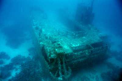
Here's a shot of the stern of the ship.
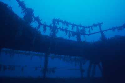
This shot is taken from the main deck and is looking out the stern of the ship. You can see the railings and the marine growth on them.
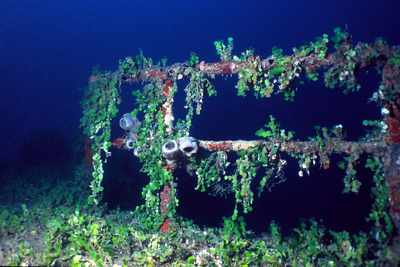
A closer shot of the railing near the stern. This time the strobe adds some color!
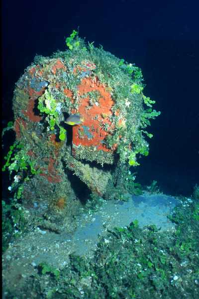
Just some little vent. the sponge growth colors it nicely.
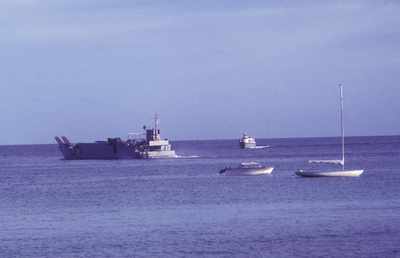
This photo is of LCU-22 operating in the Kwajalein Lagoon in 1969. Luckily, Scott Johnson was here to capture this photo before it was scuttled in January of 1971!
Photo by Scott Johnson

Nearby Attractions:


From: LCU-22
AttractionDistance (feet)Bearing (deg mag)
North Loi Wreck 680 65


Go to Map Based Wreck Directory

Go to List Based Wreck Directory

Go to Wreck Page

Go to Scuba Diving Page

Go to Dave Fortin's Homepage

Send e-mail to Dave Fortin


This page has been accessed 13 times.

Created by Dave Fortin

Thu Apr 25 23:40:47 UTC 2024