Huff Maru


Local Name:

Huff Maru

Depth:

Approximately 120 feet to the bottom.

Length and Orientation info:


The approximate length and approximate orientation of the ship are deteremined based on the lat and lon of the bow and stern. Typically, the lat/lon information was obtained by attaching a line with a float to the wreck and marking the position of the float with a handheld GPS receiver. We try to get the line as near vertical as possible, but there is bound to be some error. Also, the GPS position will have a certain error in it as well. So, this information will be reasonable, but not 100 percent accurate.

Stern Position:
Latitude : 8 deg 49.987 min 0 sec
Longitude: 167 deg 44.068 min 0 sec

Bow Position:
Latitude : 8 deg 50.006 min 0 sec
Longitude: 167 deg 44.075 min 0 sec

Approximate length: feet

Approximate orientation: deg mag

Anchoring:

On 1/23/05 we tried a new approach to diving this wreck. In the past I had always anchored on the wreck. This area near the wreck is rather deep to anchor. The area is generally sandy, but there is a patch of coral off the starboard bow which you can hook, but then your anchor is deep. We found that if we motored over the wreck and then headed straight in to the shallows and anchored, this worked very well. Get the bearing to the wreck from you GPS and swim out. The distance should be about 500 feet. We swam it at a casual pace and got there in 5 minutes. Stay high to save air and bottom time. By doing this and swimming back, you can now spend a fair amount of time up in the shallows near your boat after doing the wreck. This particular day things worked out very well. We swam back within 50 feet of the boat and a manta ray was swimming towards us from under our boat! The area is frequented by mantas, so this was a much better approach and I highly recommend diving this wreck this way!

Location:

Latitude Longitude
Degrees Minutes Seconds Degrees Minutes Seconds
8 49 59.280 167 44 4.320
8 49.98800 --------- 167 44.07200 ---------
8.83313 --------- --------- 167.73453 --------- ---------

Notes:

This wreck is very similar to our Ski Area Wreck. You can see the configuration of the hold is very familar. And it is not all that different from the Shell Island Wreck, Phantom Maru or perhaps even the North Loi Wreck.

There are refridgeration coils in the forward holds. There is a large hole on the starboard side of the ship towards the stern which no doubt play a significant role in its sinking! The deck immediately above the hole is also blown upwards.

I sent up marker float on the tip of the bowsprit and another at the stern. Based on the positions I recorded using my GPS, the ship measure approxiametly 125 feet in length and is on a bearing of approximately 8 degrees (mag).

Photos:

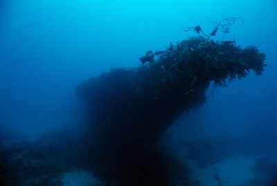
Here's a shot of the bow. You can see an old temporary marker buoy line hanging off the wreck on the right. If you look closely you might be able to see out anchor line on the left side of the frame. GPS is great!
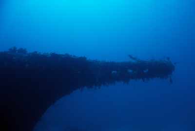
Another view of the bow. This time from the starboard side.
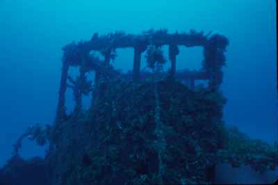
The bridge.
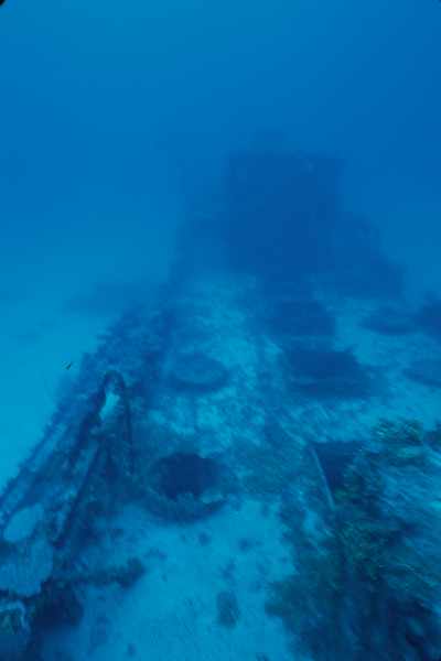
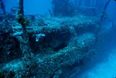
Here's a shot of the holds. If you look at the Ski Area Wreck page you'll find a photo that is very similar. Note the rectangular hatches down the middle of the deck and round hatches on either side of them.
Again, another shot similar to the Ski Area Wreck. This shot is looking back down the starboard side of the ship.
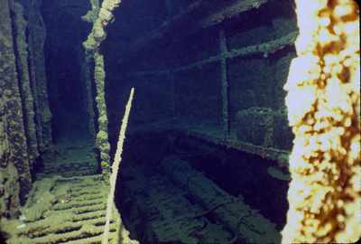
This shot is a little dark. The larger image might be easier to see. You can see a couple batteries on the back shelf and the rocker arms on the engine below.
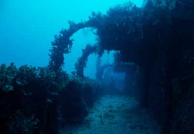
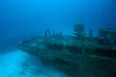
While the deck is down at about 100 feet, this shot was taken on a very clear day. I forget the depth, but I want ot say it was from maybe 30 or 40 feet. While not the best shot, it gives you a fair overview of a good portion of the wreck.
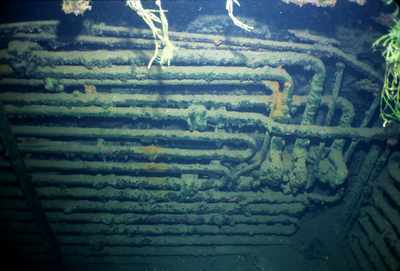
This is a shot inside one of the forward holds. This appears to be refridgeration coils.
Now we see what sent this thing to the bottom! This is on the starboard side towards the stern. There is a large hole in the side of the ship and one coming up through the deck right above it.
Another shot of the starboard side and stern showing the large hole in the side of the ship.


Go to Map Based Wreck Directory

Go to List Based Wreck Directory

Go to Wreck Page

Go to Scuba Diving Page

Go to Dave Fortin's Homepage

Send e-mail to Dave Fortin


This page has been accessed 17 times.

Created by Dave Fortin

Thu Apr 25 03:52:42 UTC 2024