|
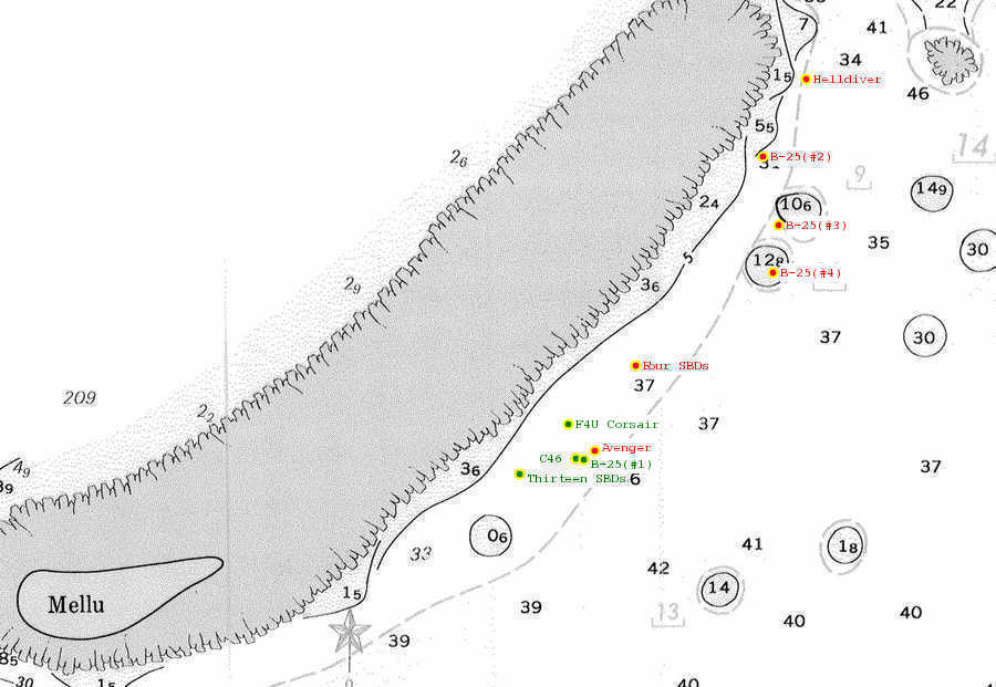
Click on one of the wreck markers (red/green dots) on the map to see more details about the wreck. RED dots/names indicate no photos available for this wreck. GREEN dots/names indicate photos are available for this wreck. (S) Indicates that a Surface buoy is normally available for this wreck. (SS) Indicates that a Sub-Surface buoy is normally available for this wreck. |

|